
Interactive Maps
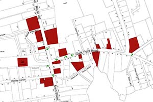
In July 2015 the Library presented the Southwest Harbor Then & Now show as a visual stroll down Main Street and Clark Point Road. The show was composed of historical photographs contrasted with new images of the same places as they are today. The map shows 34 locations and over 100 photos that tell part of the history of the town.
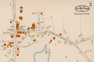
This interactive tour of Southwest Harbor, Maine has three maps created by the Sanborn Map Company in 1921. Sanborn created the maps to allow fire insurance companies to assess their total liability in urbanized areas of the United States. Together the three maps in this tour show 45 locations and some 150 photographs.
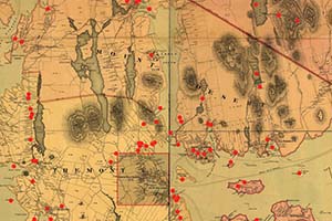
This map was published in 1887 by Joseph Harry Stuart and George Nehemiah Colby. Depicting Mount Desert Island and Acadia National Park at the height of the guilded age, it shows topography, roads, property lots, grand hotels, lodges, and more. This interactive version of the map shows 192 locations and more than 600 photographs.